


“We’ll get a convertible,” I told Michael when we began planning our road trip to Nova Scotia and Prince Edward Island. He smiled, knowing that I say that every time we rent a car.
Stepping out of the airport in Halifax in mid-August, we knew we made the right choice. There really is no better way to explore the eastern Atlantic Provinces – by land – than cruising with the top down.
Heading north along Veteran’s Memorial Highway (Highway 102) in our Sebring towards the Northumberland Strait, iPod set to his 'Road trip' playlist (Lady Gaga, La Roux, songs from Glee, etc.), we began our seafood-centric adventure.
Oysters, lobsters, scallops and mussels take note – we’re on our way.
Heading east on the Trans-Canada Highway (Highway 104) towards Cape Breton Island, we eyed a sign which read, “Sunrise Trail - Cape George Scenic Drive.”
“Detour!”
Veering north onto Route 245, hugging the coast, we drove through several fishing villages overlooking the Northumberland Strait. We passed through Arisaig, a lobster fishing village and then followed the signs to the Cape George Day Park, climbing the rolling hills towards the peak. We took the short hike from the park to the Cape George Point Lighthouse and took in the view across the water to the Cape Breton Island highlands.
After our short break, we continued along Route 337 towards our original route, passing through Ballantyne’s Cove, which we discovered is the world’s leading supplier of Bluefin tuna. Being sushi lovers, we stopped, only to learn that fishing season begins in September.
Ballantyne’s Cove
 At the end of our detour, we stopped for a great lunch at Gabrieau's Bistro on Main Street in Antigonish. We then rejoined the Trans-Canada Highway and continued eastward crossing the causeway over the Strait of Canso that separates the mainland from Cape Breton Island.
Heading north, we followed the winding Ceilidh Trail (Route 10) along the western shore of Cape Breton Island. Passing by seaside communities and the Mabou Highlands, we enjoyed views of the rugged coastline and cliffs, bays and harbors, and an abundance of farms along the way.
Crossing through Margaree Harbor, we admired the two lighthouses protecting the village. Just past the harbor, we began our drive along the Cabot Trail, as we traveled north to the Acadian fishing village of Chéticamp, our stop for the night.
After checking out the local restaurants, we were dismayed to learn that not one had any oysters. Since the closest place that was serving them was one-half hour away in Pleasant Bay, we drove north into the Cape Breton Highlands National Park, over the mountains, towards the Rusty Anchor Restaurant.
With the sound of the surf crashing against the cliffs below, Michael and I took in the incredible views of not only the ocean below, but also the park's highlands and mountains.
Just minutes after we laughed at our first "Moose Crossing" sign, we noticed a car pulled over to the side of the road. As we approached, we saw a couple taking pictures of a female moose nibbling on a roadside shrub.
We slowed down to admire the moose, but kept on driving towards our oysters.
At the restaurant, owner Donna Timmons explained that many of the local oyster beds had been damaged a few years ago. As a result, she served her customers whatever oysters she could get her hands on. Fortunately, her supply of Malpeques had arrived that day, so Michael and I ordered those along with our lobster rolls.
We hope that we won't be limited in our oyster selections during the rest of our stay in Nova Scotia.
Arising early the next morning, we drove north back into the park along the Cabot Trail.
 We passed through Pleasant Bay and a few picturesque fishing villages, occasionally heading towards the cliffs, hoping to spot some whales. Unfortunately, none were to be seen.
After only a short time in the car, we passed a “Bog Tail” sign, so we pulled off the highway for a short hike. Eagles flew overhead, as we hiked along the trail. While we expected to see another moose (which we did) and perhaps a black bear (which we did not), we were surprised to find a variety of orchids in bloom.
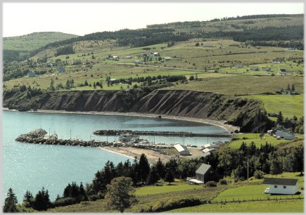
Heading south along the Atlantic coast, we drove past lighthouses and fishing villages such as Neil’s Harbor, where piles of lobster traps covered the wharfs. Harbor after harbor sported brightly painted boats adding splashes of color to the scenery.
 Along the way, we kept seeing signs for puffin boat tours.
 Having nothing better to do, we followed the Donelda's Puffin Boat Tours signs towards Englishtown.
Michael and I and another couple joined Donelda and her husband on a two and one-half hour cruise around the Bird Islands.
We learned that Atlantic Puffins are actually very small birds, about the size of sparrows. I'm glad we brought a camera with
 a zoom lens!
We saw several puffins bobbing in the water, and a few mid-air. Dozens of both Great and Double-breasted Cormorants sunned themselves along the rocky shores of the islands. Young bald eagles occasionally perched along the islands' peaks.
 Off in the distance we saw what appeared to be floating footballs in the water. As we got closet, we were pleasantly greeted by playful seals -- lots of them.
Returning to shore, we hopped back into the convertible and continued south through several more towns, finally reaching Baddeck, our home for the night.
Our summer road trip is off to a great start. We'll write more in a few days, stay tuned.